

Bogi Walu
An unforecast gale wraps up our passage to Fiji.

Science is the art of naming things so that you can blame them.
—Bob “MetBob” McDavit
We rely on numerical weather models and software that interprets them. They help us anticipate the weather and plan accordingly. They are very accurate. Until they aren’t. That is how we wound up in our first gale1 aboard Roam.
When preparing for a passage, we look first for a comfortable sea state—ideally less than 2.5-meter waves with a long period between them. Then we look for moderate winds blowing in the right direction. We look for situations where these conditions will persist long enough for us to get to our destination. We saw those conditions developing on the route from the remote Tongan island of Niautoputapu to Fiji.
It’s a 430nm trip from Tonga to Fiji. Actually, it’s only about 300nm to Fiji, but once you make landfall, you have to keep sailing into the heart of the country in order to reach a port where you can clear customs and immigration. That was the port of Savasavu. At our typical speeds, we needed two full days to comfortably make the trip. The models suggested we had a good window for the passage.

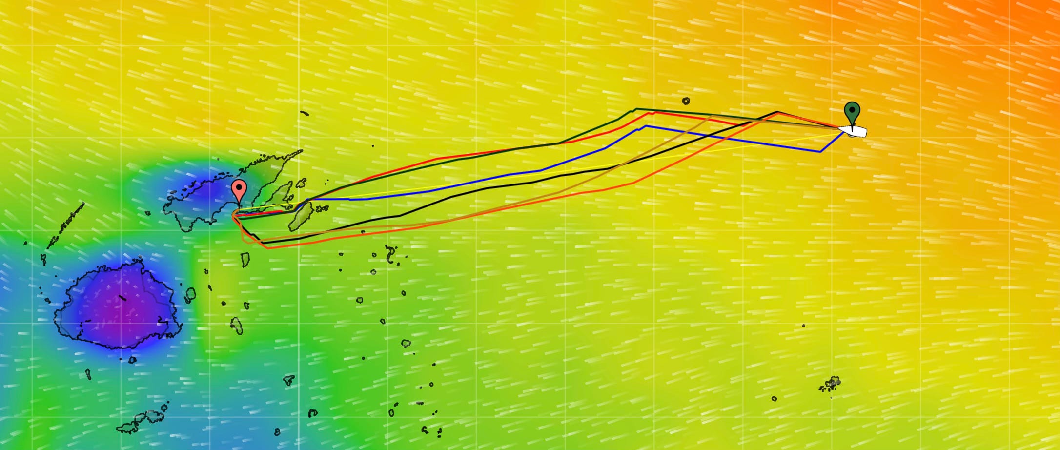
We ran the plan by our weather guru and router, MetBob. He agreed and sent us his take on the conditions.
Hi there Jim
Yes a Sunday departure from Niuatoputapu to Savusavu (if allowable by custom clearance). The South Pacific convergence zone is nearby to the north but hopefully doesn’t get closer.
Here is how it might go as shown on a weather map for Monday, possible position circled. Here is a graph of that. Peak swell 2.5m 9 seconds from SE
Any questions?


We cleared customs in Niautoputapu and set our alarms for dawn. Sunday morning, we motored out of the pass and set a course for Fiji.
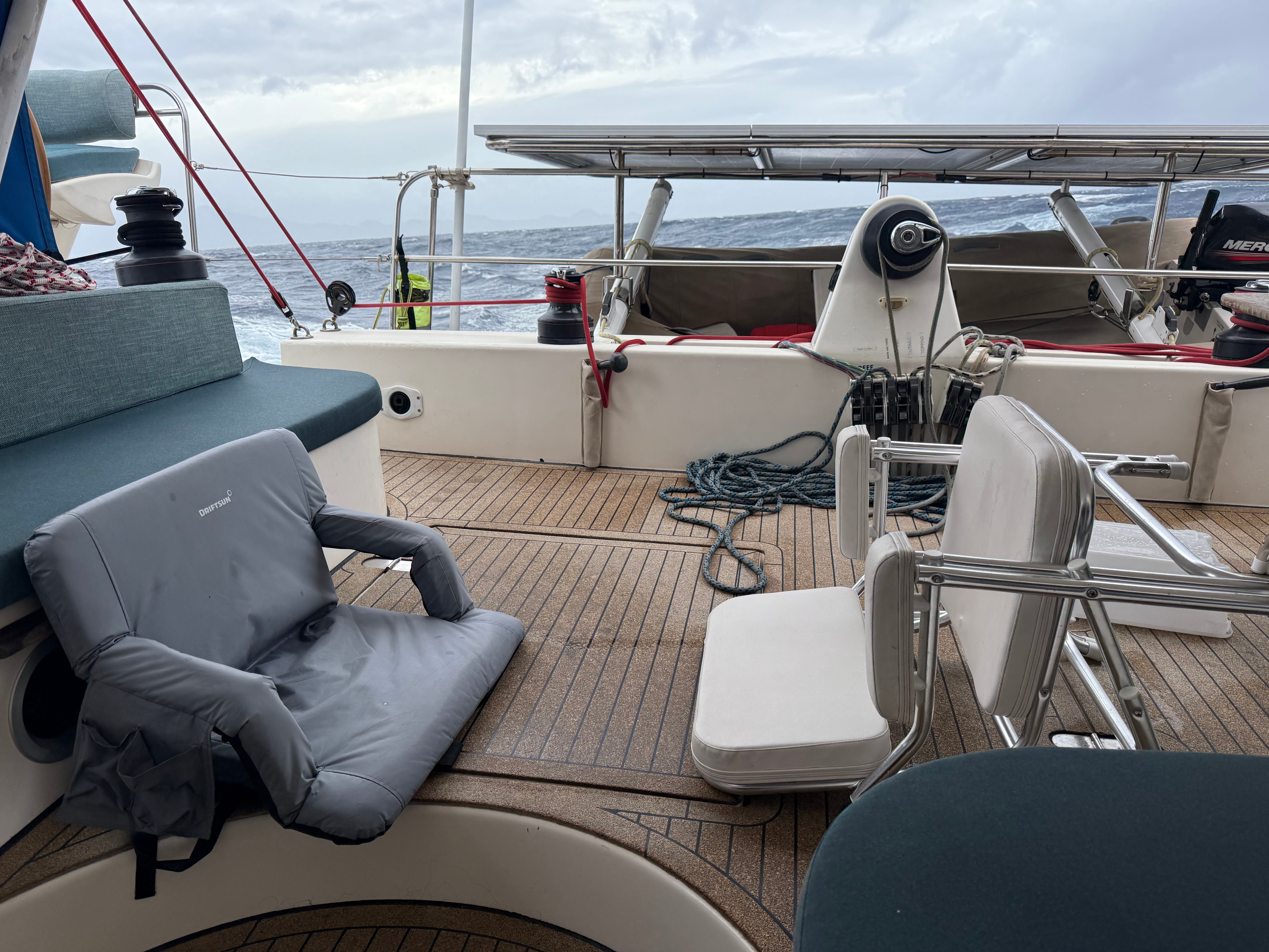
The passage unfolded as expected. 2m - 2.5m quartering seas on a long period. The wind built into the mid-20 knot range as anticipated. We were moving fast.
Landfall
We made landfall on Fiji in the early hours of the second day. As the morning wore on, the wind continued to build and along with it, the seas. The wind strength continued to climb into the mid-30s. This wasn’t in the plan.
We had a decision to make. Seek shelter behind the outer islands or press on to Savausavu Bay. At this point, the boat was handling the conditions well, with a double-reefed main and a double-reefed solent. The forecasted conditions were manageable and we were configured for them. We pushed on.
Ducking behind one of the outer islands would mean more complex navigation in an unfamiliar area. Risky given our fatigue level. We also weren’t officially cleared into the country. While safety at sea permits a captain the option of stopping without clearing in, it can raise suspicion and subject you to boarding, inspections, and general harassment. This shouldn’t be a factor in these decisions, but it is.
By this time we were tired. We had been up most of the night managing the landfall, making sure we didn’t run into an island or a reef. The charts aren’t always accurate in this part of the Pacific. You have to keep a lookout and utilize multiple cartography sources. The stress of the landfall combined with the wind and seas takes a toll.
The Wind & Seas Keep Building
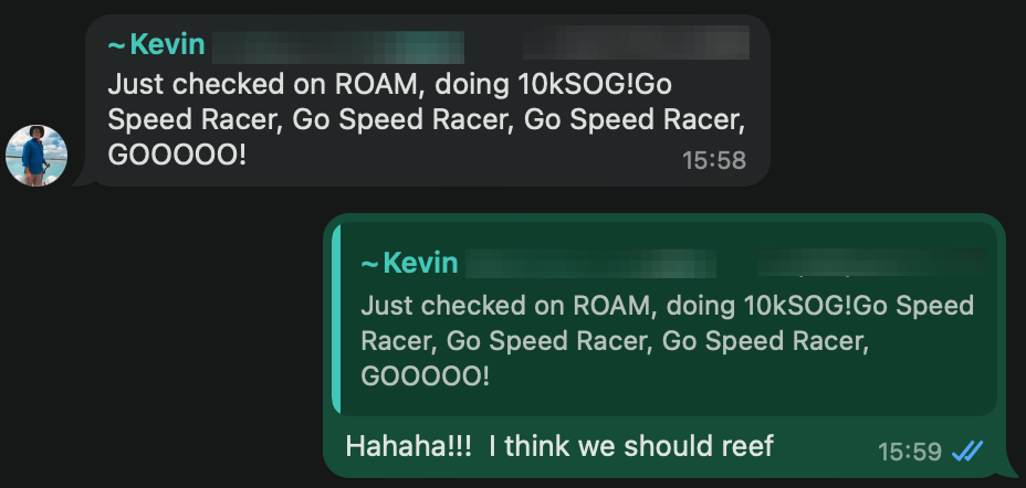
The wind didn’t stop. We were seeing gusts into the low 40-knot range. The seas had built to 10 feet and had become quite steep. The outgoing tide was pushing against them. The boat was rocketing down the waves—as high as 17 knots—twice the speed we typically sail. It was LOUD and difficult to move around.
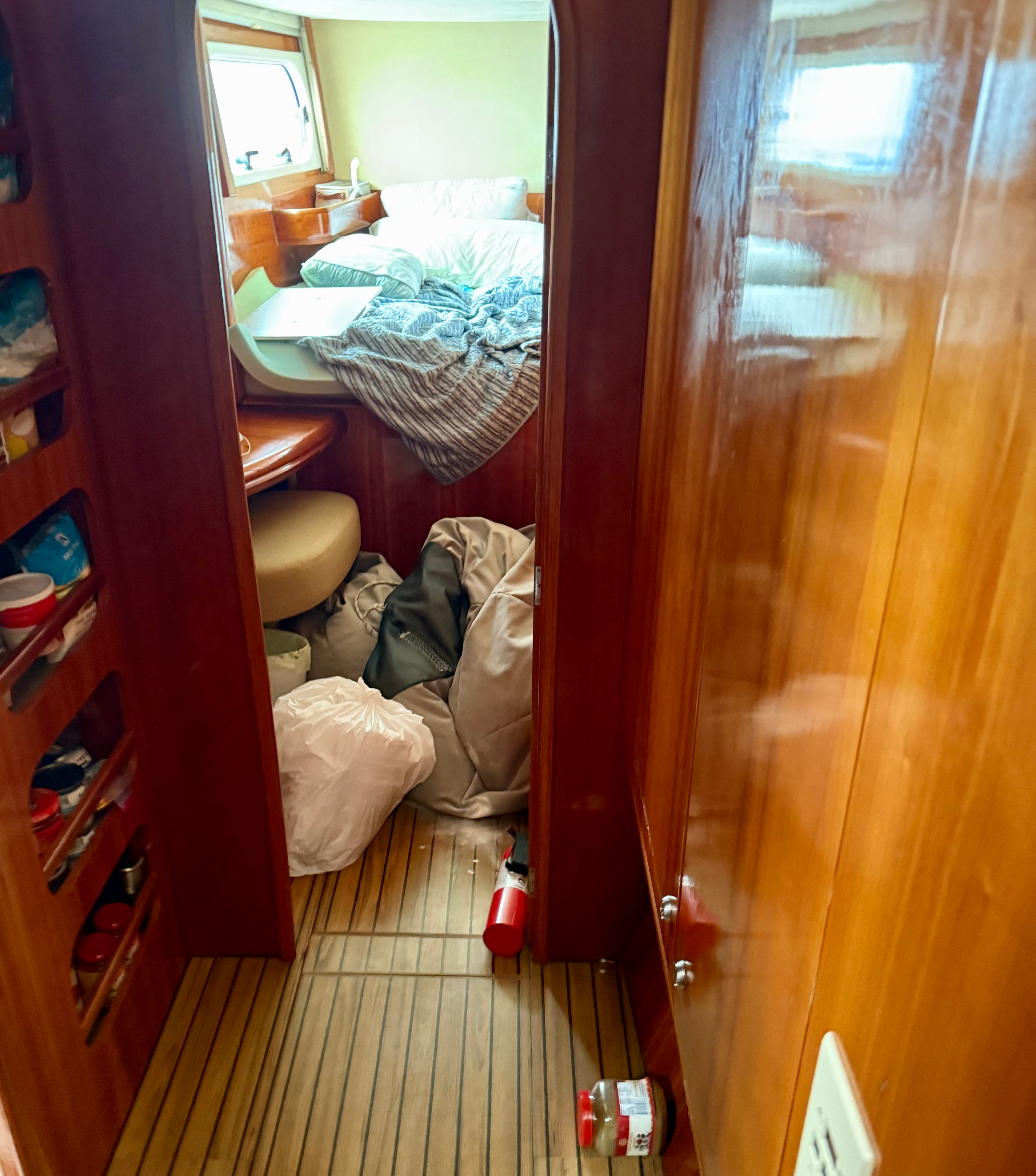
Stuff was getting tossed around inside. A fire extinguisher came loose in the port hull and discharged itself all over the floor. The cleaning supply cabinet opened itself and launched all things cleaning onto the floor. Things were generally a salty mess.
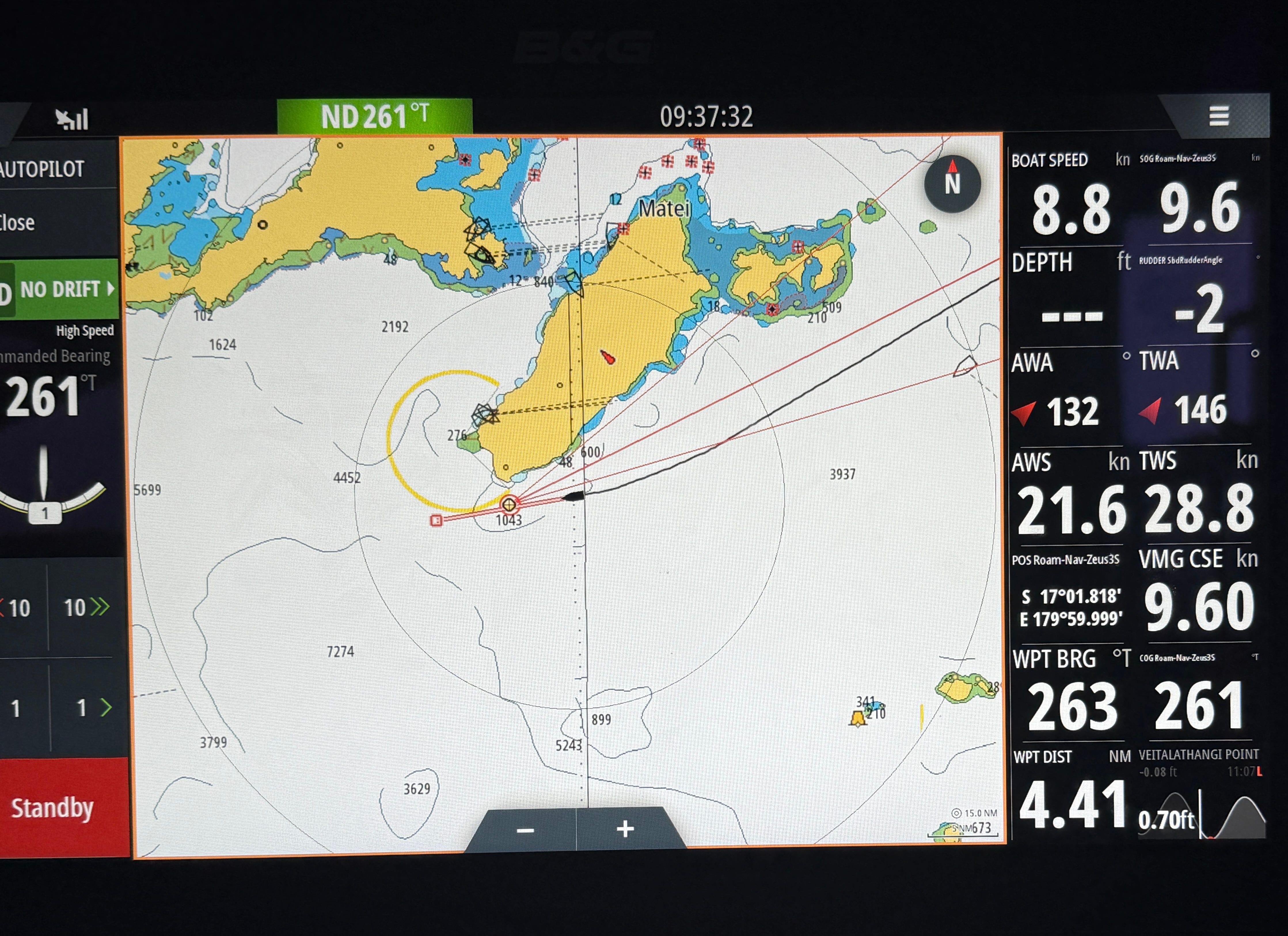
Running out of Runway
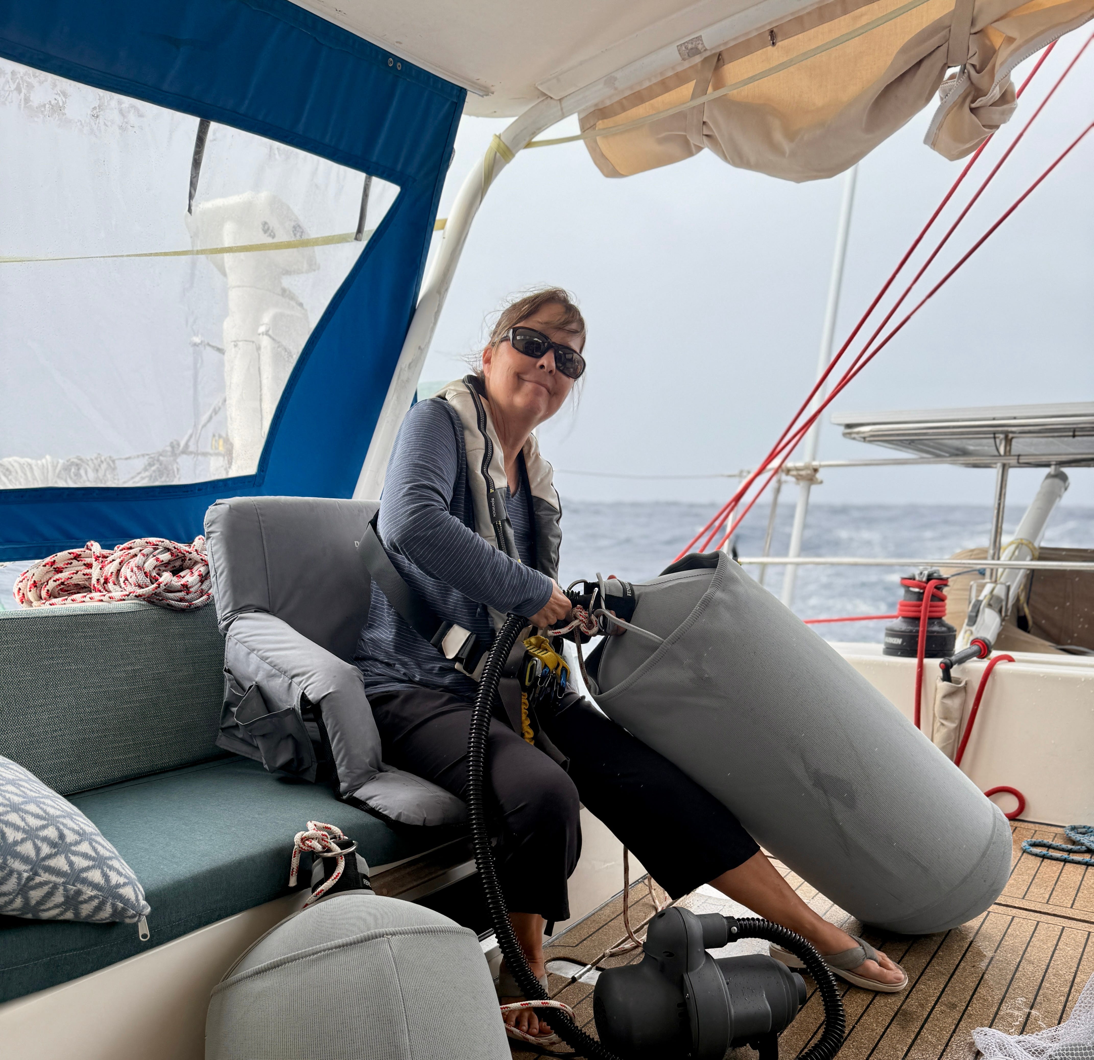
As we closed on the coast, we saw consistent winds in the mid-40-knot range. Clearly, something had changed that the models didn’t predict. We were going to need a lot of sea room to get the sails down and the engines started. Sometimes when we have been sailing fast for a long time, the raw-water cooling system in the engines needs to be re-primed. This would be difficult in the rough conditions and would take some time.
With 30 miles to go, we decided to start the process of dousing the main and starting the engines. In these conditions, we can’t turn the boat into the wind to drop the main. It’s risky and it beats up the boat and crew. We have a technique for dousing while sailing downwind, but we hadn’t tried it in this kind of wind. As we were dousing the main, the port lazy jack mast block exploded, dumping the main everywhere. The sail sprawled all over the deck.
The port engine started fine, but the starboard engine raw water cooling needed priming. That took time. I have to crawl into the engine room with bottles of water and pour them into the raw water strainer. By the time we got the main down and the engines started, we’d used up 20 of those 30 miles.
The autopilot did a great job of handling the big quartering seas in that wind. This is the big test of any autopilot system. I decided to spend the last two hours hand steering so I could get a better sense of how the boat was handling the conditions. It was the first time we’d had wind and seas like that since we’ve owned Roam. She is solid and confident. Other than getting soaked, it was a fun sail.
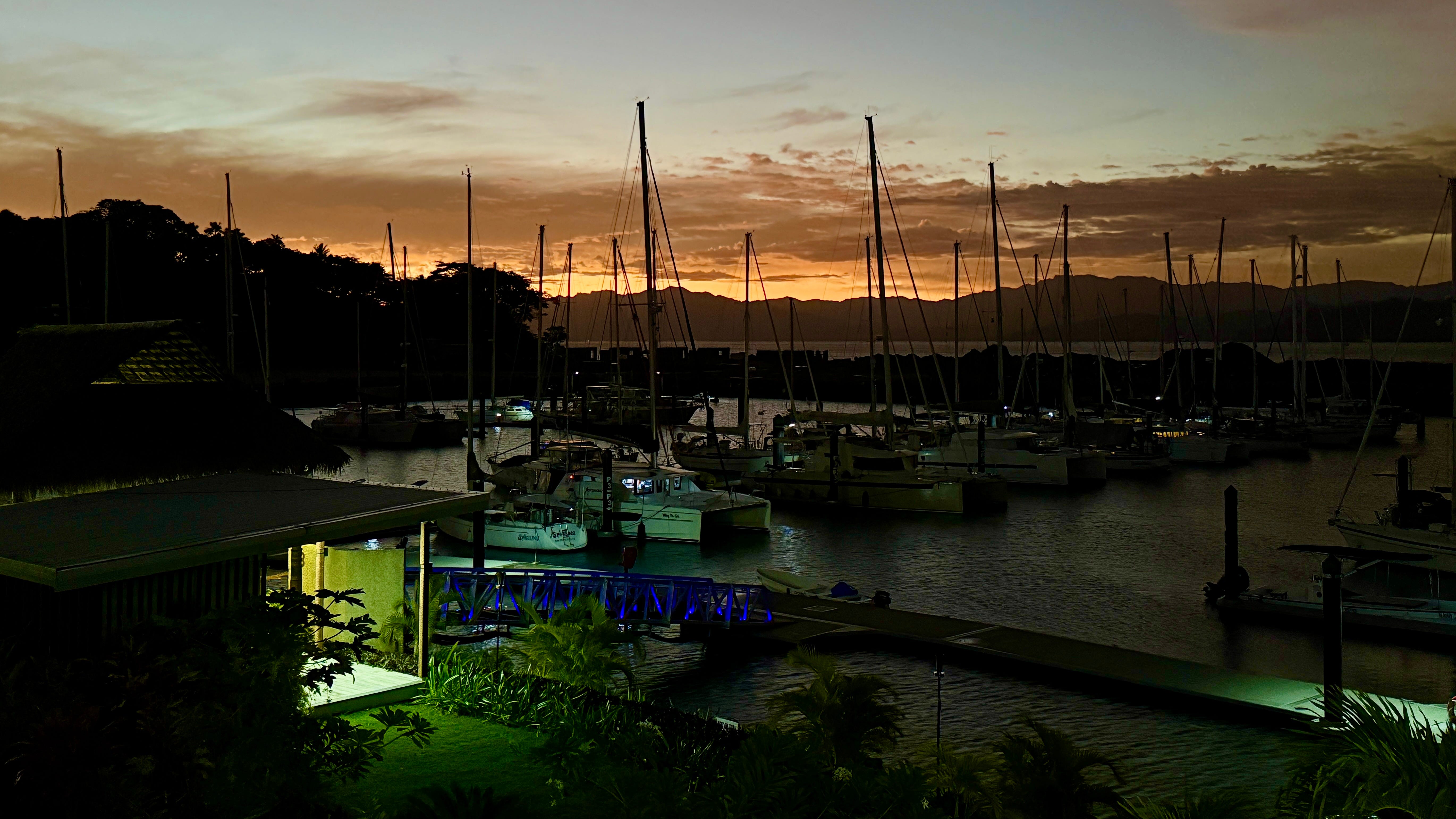
Safe in Savusavu Bay
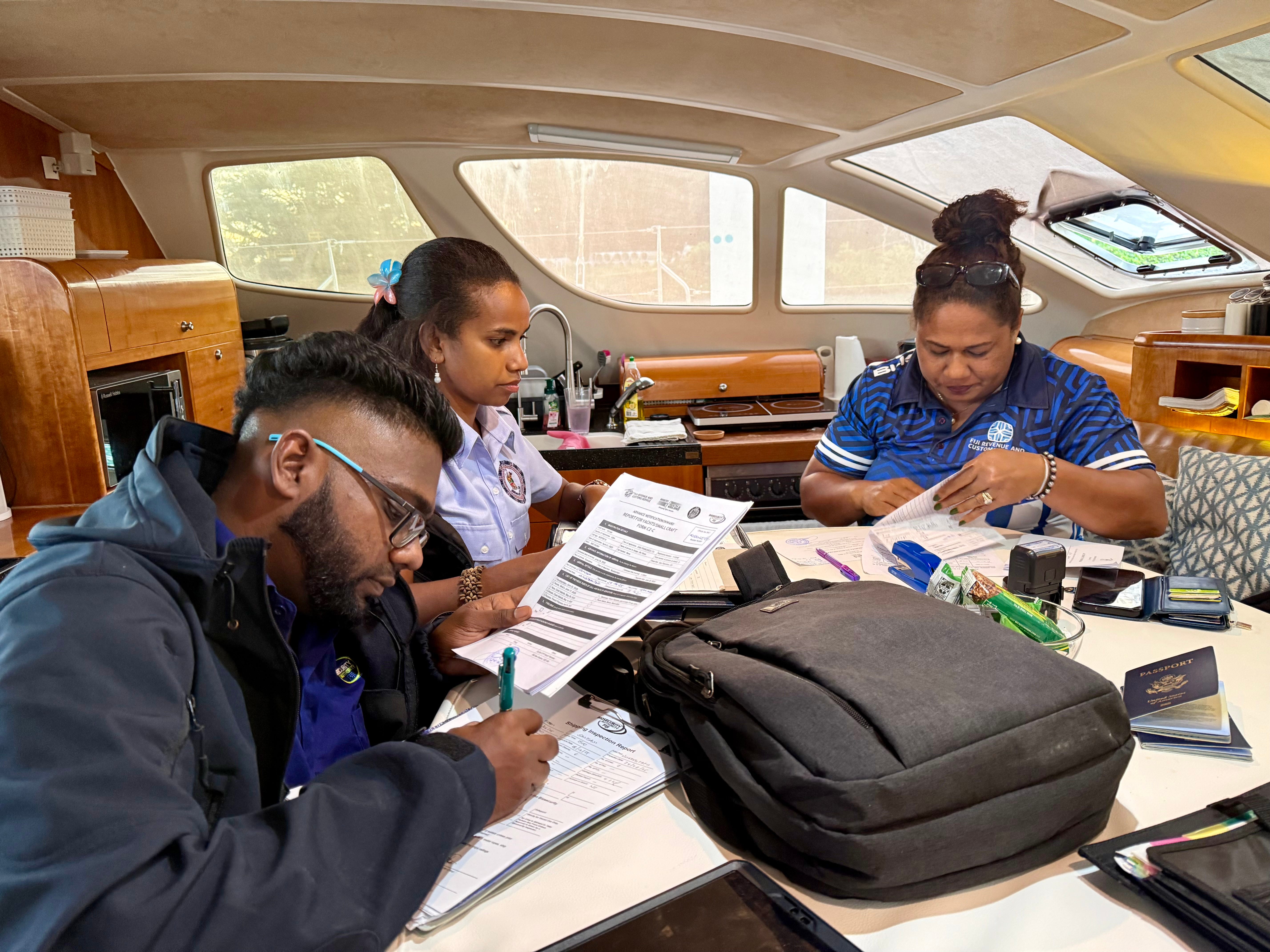
As we sailed into the shelter of Savusavu Bay, the seas flattened out. We furled the remaining solent and set a course for Nawi Island where we could tie up and clear customs and immigration. 30 minutes later the marina sent a boat out to guide us in and helped us tie to the quarantine dock.
The marina staff shuttled various officials over to us to complete the check in process—health inspector, bio-security, customs, immigration. By 6pm it was all done. The marina let us spend the night at the quarantine dock. We were too tired to move to our assigned berth. We treated ourselves to a hot shower and a well-deserved cheeseburger at the marina restaurant.
What Happened with the Weather Forecast?
Here is how MetBob described it:
The stuff you went thru is a boost of energy tied up in a ripple in the upper winds. It descended to the surface as a brief circulation of the surface wins east of Niue yesterday … a LOW. And, is now just a trough and going west wards towards Tonga
The ripples in the flow start so small that the chance they get measured by a weather balloon is almost nil.
Consider yourself blessed to have encountered one, they are rare in the South Pacific.
Blessed indeed!
Nadraki Weather provides weather routing services for the Island Pacific Rally (we are participants in it). Here is how they explained what happened:
What was your typical dry season weather pattern yesterday has morphed somewhat over the past 24 hours as an upper level trough developed a bit more than expected, and as a consequence a fairly insipid frontal system expected to pass to our south has amplified into a significant weather system approaching from the west, thanks to the strengthening west-northwest winds in the middle and upper levels.
What is unusual is the strong vertical wind shear over Fiji - at the surface we have southeast trade winds of 20 to 30 knots but at around 5.5km (18,000 feet) altitude above the ground we have northwesterlies of 70 to 90 knots. It's going to be quite rough for pilots flying in our local region, especially the smaller planes who generally operate at around these altitudes2.
Meanwhile, the strong high pressure system centred close to Norfolk Island yesterday is now located just north of the Bay of Plenty region. We have what is essentially a Bogi Walu event in action, with the strong high to the south maintaining the fresh to strong and blustery trade winds over Fiji today which, combined with the low humidity, will mean that temperatures will feel quite cool overnight, and if you're out of the sun during the day.
“Bogi Walu” is a Fijian term that literally means "8 nights" and refers to a specific weather phenomenon in Fij where the isobars within the trade winds are forced closer together, creating a "trade-wind-squash-zone" that results in stronger trade winds, typically lasting about eight nights (a week and a day).
Thinking Back On It
Despite the conditions, many things went right. While it wasn’t what we expected, it was a good passage plan. The boat handled the conditions well. It exceeded our expectations. Our autopilot is a rock! The boat sails well with a double reefed main and a reefed solent in heavy weather.
Would I change anything? Yes, I’d have rove the third reef in the main. I didn’t think we’d need it. I like to minimize the excess line hanging off the sail. It would have been helpful dousing the main while sailing downwind.
While it wasn’t part of our plan, we had ourselves a Bogi Walu Fijian welcome.
A Few Photos:
Excerpts from the Ship’s Log:
Cranking up
Sun Jun 22 2025 04:39 UTC, 15 45.682s 174 35.830w, Log: 7827.
All is well. We are presently broad reaching under a single reefed main and the Code65. 15 knots of breeze. 2m quartering sea on a long period. Daggers up.
We ran the chicken rig (Solent set to weather with a spinnaker guy, Code65 set to leeward wing and wing, no main, until this evening. The models all say it’s time to heat up and head to Fiji direct. The wind should veer a bit to the southeast as we continue down the track, improving our angle and speed over the next day.
Bumping and Grinding
Mon Jun 23 2025 02:00 UTC, 16 14.243s 177 03.564w, Log: 7979
All is well. We are presently broad reaching (TWA 140-135) under single reefed main and the Code 65. Daggers up. Seas are 2M and confused. The weather is overcast with scattered rain squalls.
The wave patterns in the South Pacific typically feature a long period southerly swell generated by the storms in the Southern Ocean with easterly wind waves on top (driven by the trade winds). That makes for lumpy, confused seas. They bang into the boat and heap up under the bridge deck. It can sometimes sound like you are inside a bass drum during a sound check.
If everything holds up, we’ll make landfall in Fiji in the morning.
Land Ho: Fiji
Mon Jun 23 2025 22:06 UTC, 16 31.643s 179 04.603w, Log: 8101.
All is well. We are presently beam reaching under double reefed main and double reefed Solent. Daggers at 1/3.
Seas are around 2.5 meters and confused. Winds 25-30 TWA 100.
This has been a rough night. Going fast in lots of breeze with shortening sea state. Now that we are inside Fiji territorial waters, we are hoping the islands will knock down the seas a bit.
We still need to sail another 130 miles into the heart of Fiji to reach Savusavu, the closest clearance port. We are hoping to arrive before the forecasted increased winds arrive.
A gale in sailing is defined as a strong and sustained wind with speeds between 34 and 47 knots (39 - 54 mph).
No doubt it was a rough day for the airline pilots. It wasn’t exactly a cake walk for the sailors, either.
Great update! Crazy stuff happens out there but it must feel good to know you have prepared Roam well, and that you both have the experience to make it through the unexpected trials. Miss you guys!
What a journey! Glad that you both were so well prepared!