
Weather Routing
Practical passage planning without turning yourself into an amateur meteorologist
Most of what is written on the topic of weather for sailors attempts to turn sailors into amateur meteorologists. It doesn’t work.
Sure, there are some sailors who geek out on weather and get into the weeds on parcel theory, deep moist convection, and the Madden-Julian oscillation. They are the ones quick to quote the day’s 500-millibar chart. They are the weather hobbyists.
The rest of us are managing risk. We are deciding when to depart, what route to sail, what sails to set, and what conditions to expect. We are never going to understand enough about weather to out-forecast professional weather forecasters and modern forecast models. And even if we could, we don’t forecast often enough to remember how to consistently put all that knowledge and information into practical use.
How we make weather decisions
Our goal is to keep the process as simple as possible (but no simpler). We start with the tools:
- Windy.com (Premium subscription)
- PredictWind (Professional Subscription)
And employ them in a simple process:
- Big picture quick look
- Sea State
- Wind Speed and Direction
- Rain and Thunderstorms
- Departure Planning
- Routing
If it is a long passage or one where we aren’t confident in our weather conclusions, we’ll enlist the help of a professional weather router to critique our plan and challenge our thinking.
It’s Sunday, and we are thinking of departing Mo’orea for Huahine on Thursday. I’ve been watching the big picture every morning for the past week. We’ll use this upcoming passage in the example below.
Passage Planning:
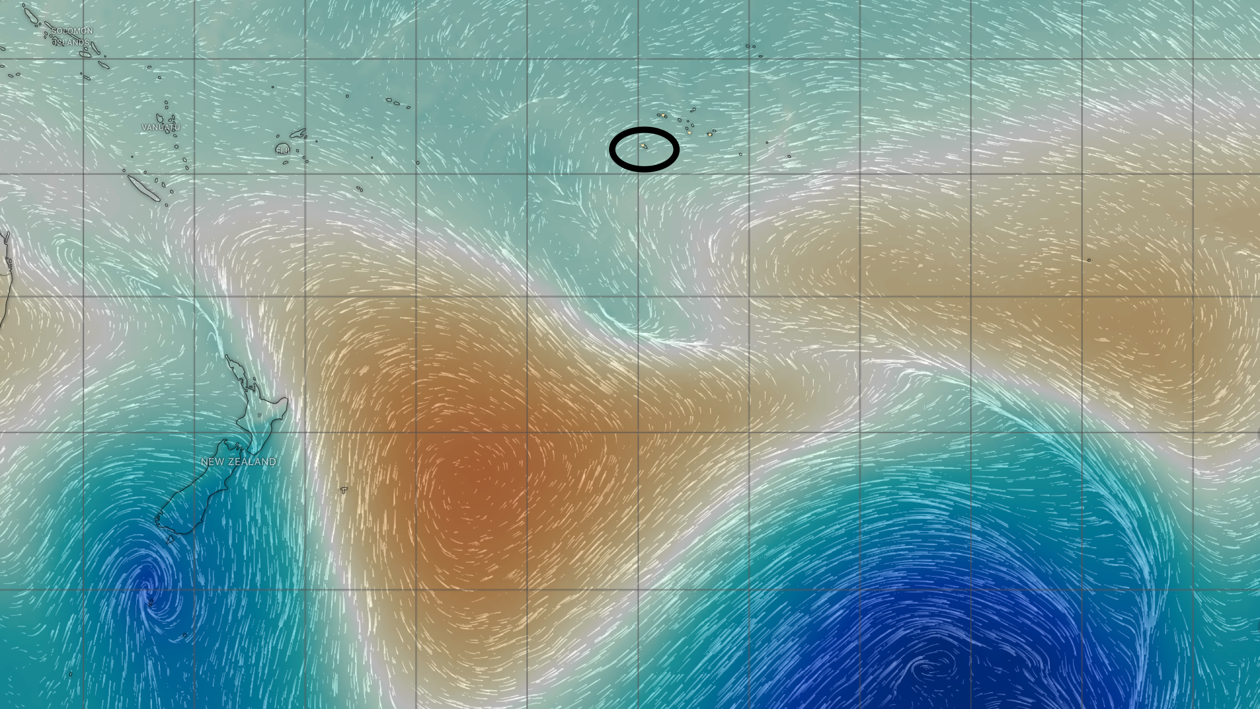
1. Big picture: Windy Pressure Map.
We zoom way out (wide enough to see New Zealand on the screen). Click through each day to see how the highs are moving across the Southern Ocean and the result they have on wind direction. This gives us a nice 10-day look at how things are going to play out. It’s very visual and it sticks in my head for days.
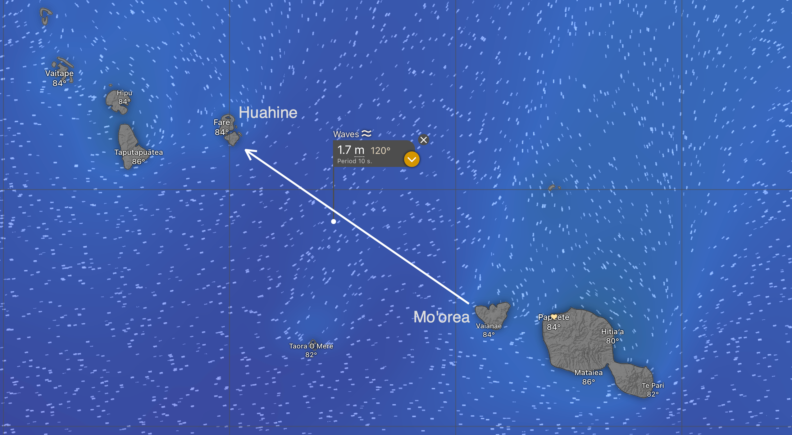
2. Sea State: Windy Wave Map
When seas are flat and calm, almost anything is possible. If the seas are rough, almost everything sucks. It’s the sea state that breaks sailors and boats, not the wind. We want less than two-meter seas. One meter is even better. We’d prefer the seas to be going in the direction we are going (following seas). They usually aren’t, but a guy can dream.
Consider the “period”—the distance (in seconds) between the waves. The longer, the better. The period needs to be at least twice the wave height (in meters) to be comfortable. 2.5x is even better. Two-meter seas need at least a four-second period. Five seconds is even better.
Both PredictWind and Windy have sea-state maps. PredictWind has more models to choose from. Windy allows you to break down the waves into component parts. The seas are always confused (waves coming from different directions). Looking at the individual wave components never changed our decision if the overall height was two meters or less.
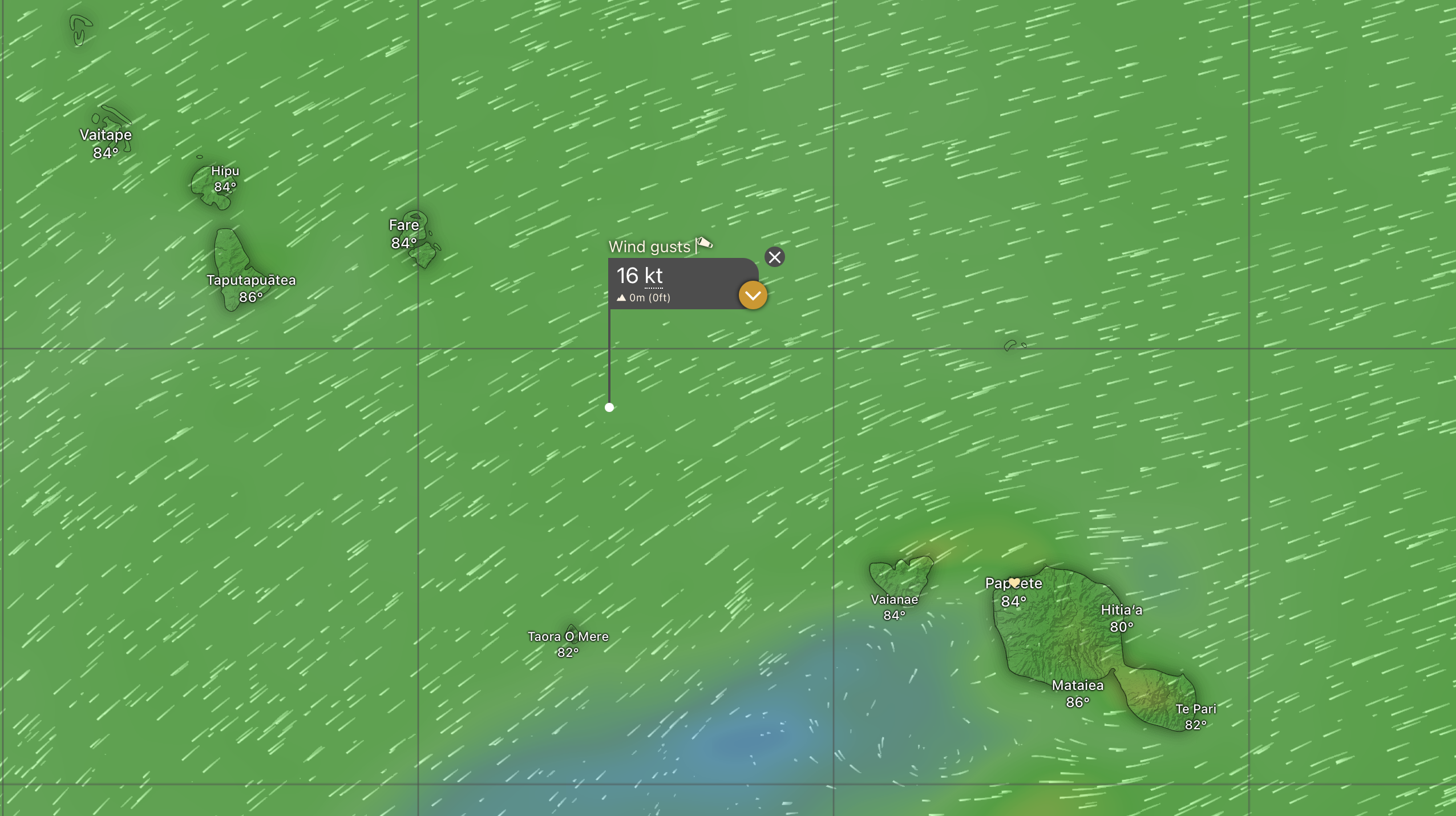
3. Wind: Windy “Wind Gusts”
We look at how hard the wind will blow and from which direction it will blow. This starts us thinking about sail selection and configuration.
We use the “Wind Gusts” map, not the “Wind” map. This is especially true of the ECMWF weather model, which chronically underestimates the wind speed.
From the wind direction, we’ll figure out the True Wind Angle across the route. That will determine our sail selection. “Jack” our Code 65 reaching sail (“Jack Reacher,” get it?) doesn’t perform well in True Wind Angles greater than 135 degrees. “Samantha,” our symmetrical spinnaker, likes True Wind Angles greater than 150 degrees.
If the seas are relatively flat, we don’t care too much about how hard the wind blows. But they go together. When the wind blows hard enough for long enough, the seas get big.
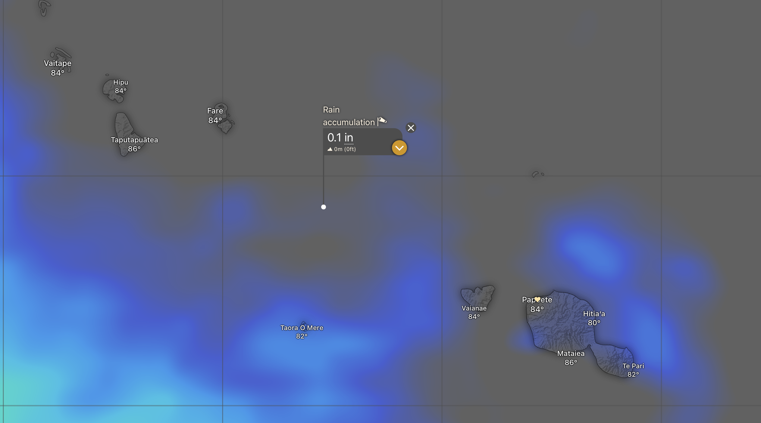
4. Rain and Thunderstorms: Windy “Rain & Thunder” and “Rain Accumulation” map
Click through the days and look at what the models think the rainfall will be. Unless it shows large, nasty thunderstorms, we’ll depart anyway and live with the rain—especially if the seas are slight and the wind is going in the right direction.
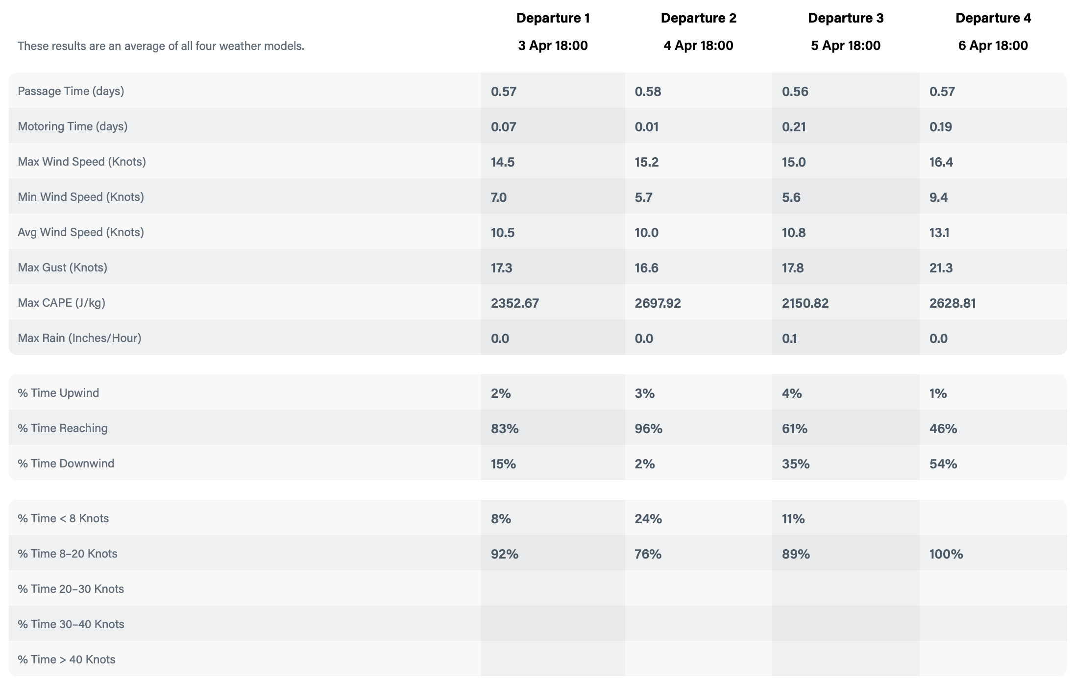
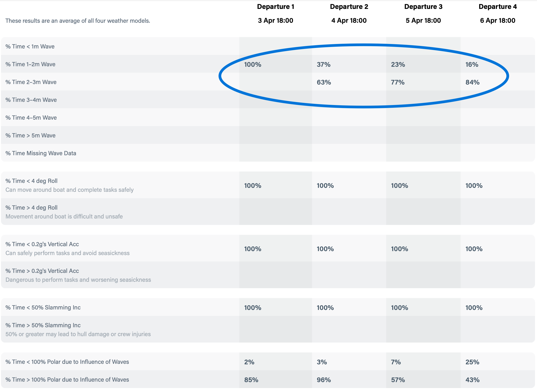
5. Departure Planning: PredictWind
The Kiwi software gurus at PredictWind have created an amazing tool for sailors. We feed it our boat’s performance potential, our desired comfort level, our start and end points, and it figures out the best day to leave and the best route to sail. It tells us the conditions to expect, which helps us prepare the boat and configure our sails.
We start with the “Departure Planning” option. It runs a series of simulations using the average of four different weather models and then lets us know which of the four departure times is best.
The data is also presented in tabular form, and it’s what we look at first. It’s clear from the simulations that Thursday evening, April 3rd, is the best day and time to go. Once again, it’s all about the sea state.
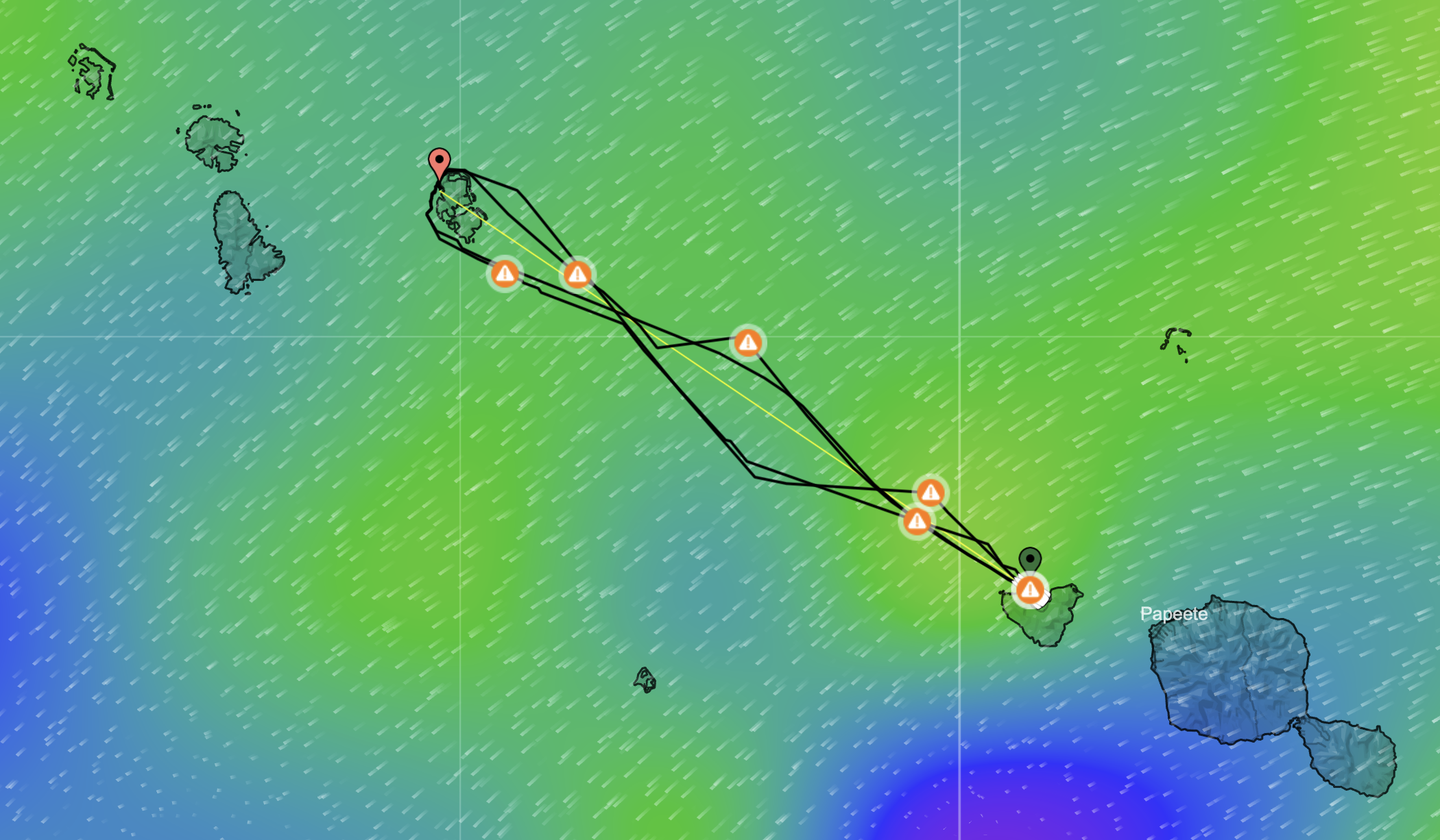
6. Sail Routing: PredictWind
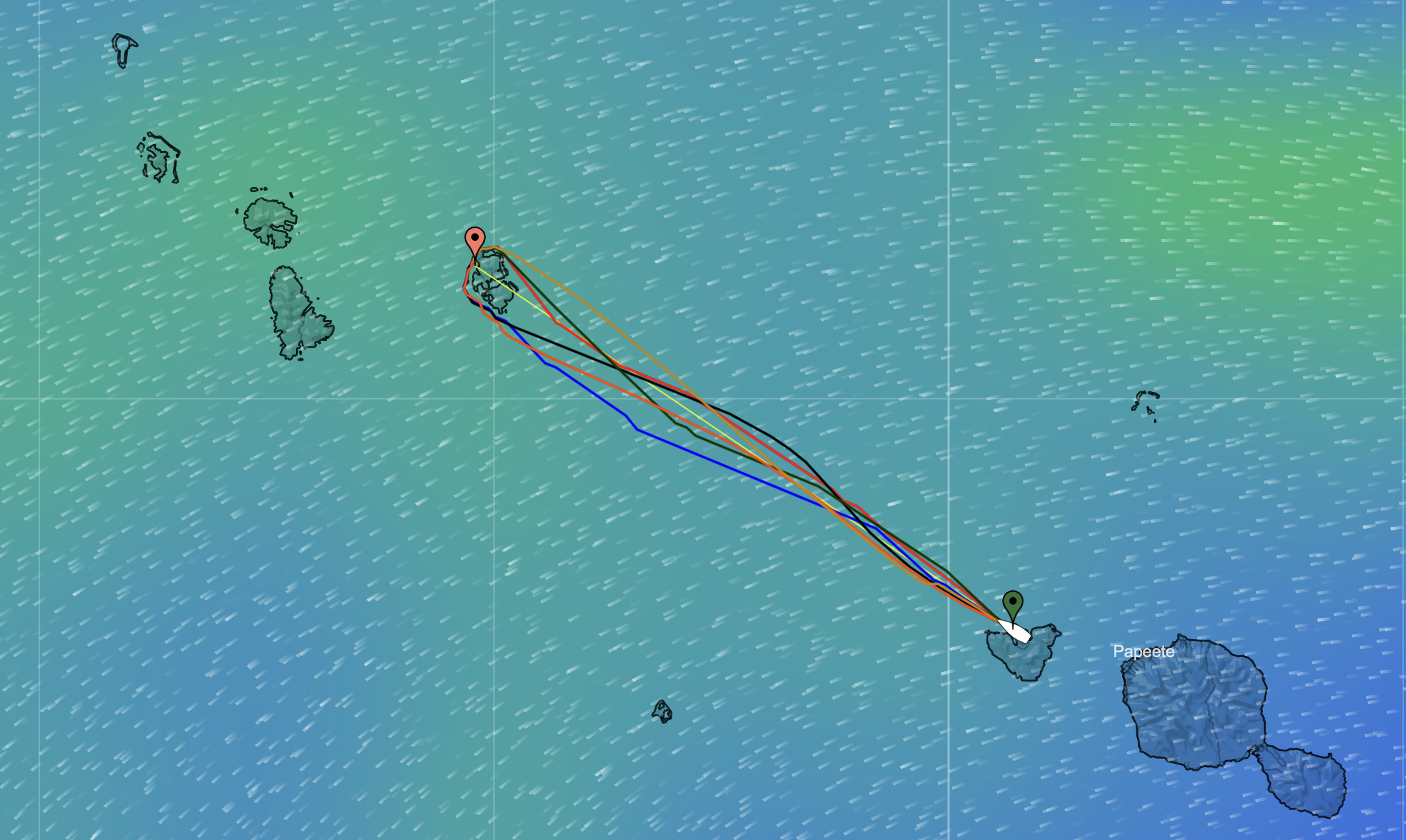
Now that we have the best day and time to depart, we can run a detailed analysis. This gives us the best route to sail, the optimum sail configuration, and the conditions we can expect.
All 7 weather models suggest sailing straight to the destination. Some suggest rounding the south end of the island. Others suggest rounding the north end. They are all reasonably consistent, which gives us high confidence in the plan. If the different models are each suggesting different routes, we have less confidence in the plan. We’ll dig into what might causing the models to disagree. We will make a final call on which way to round the island as our departure time gets closer.
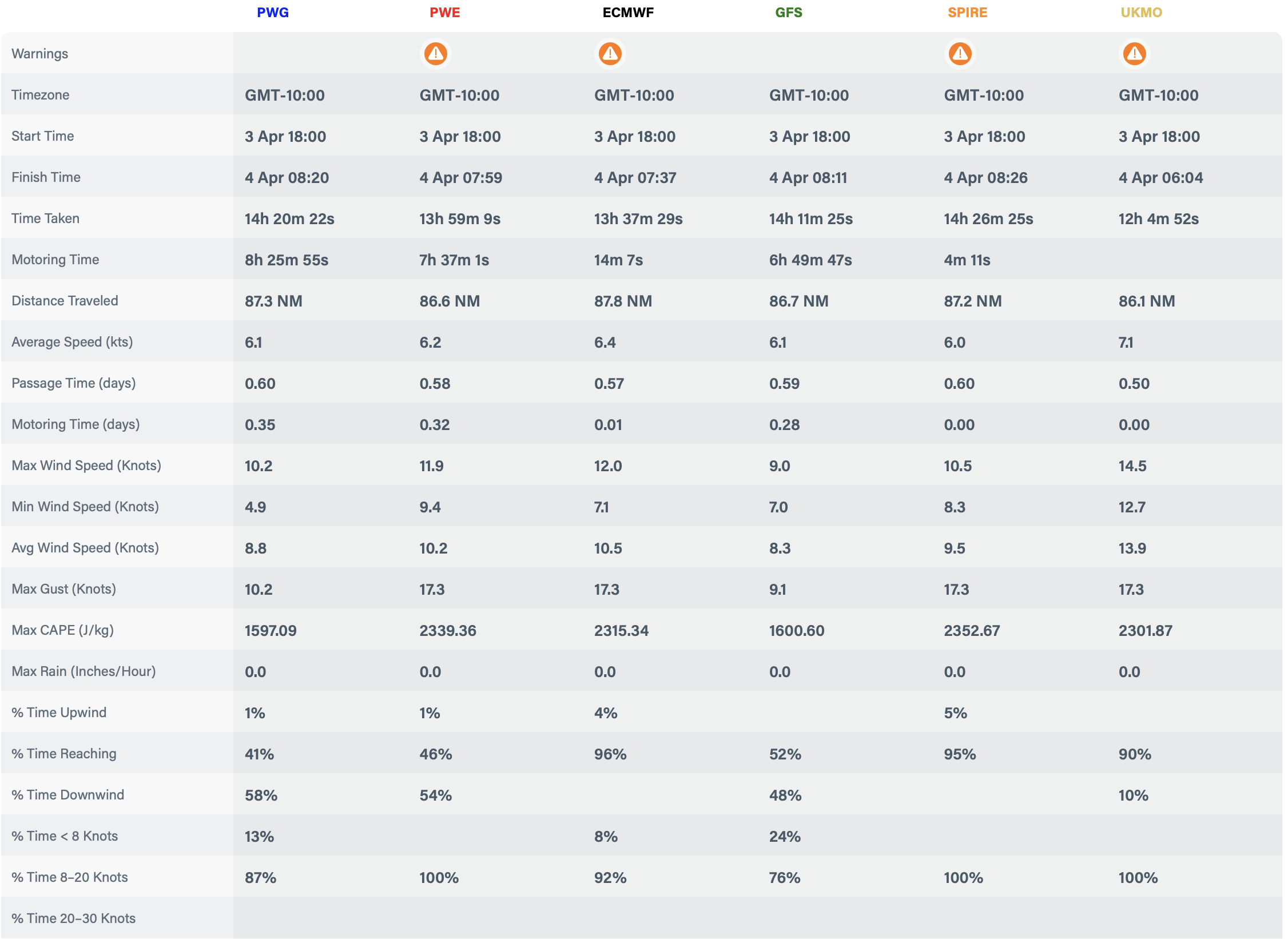
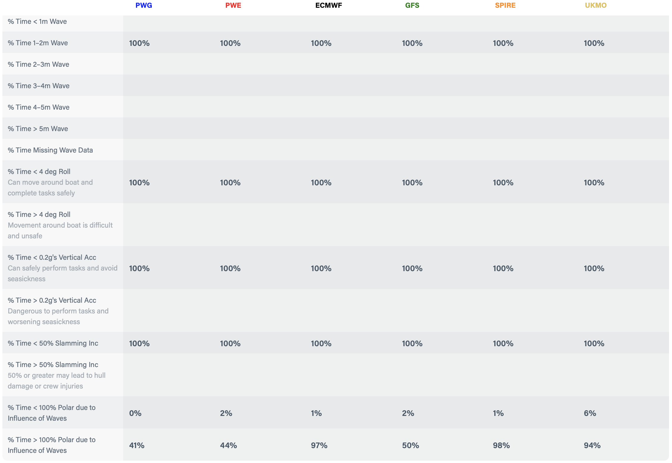
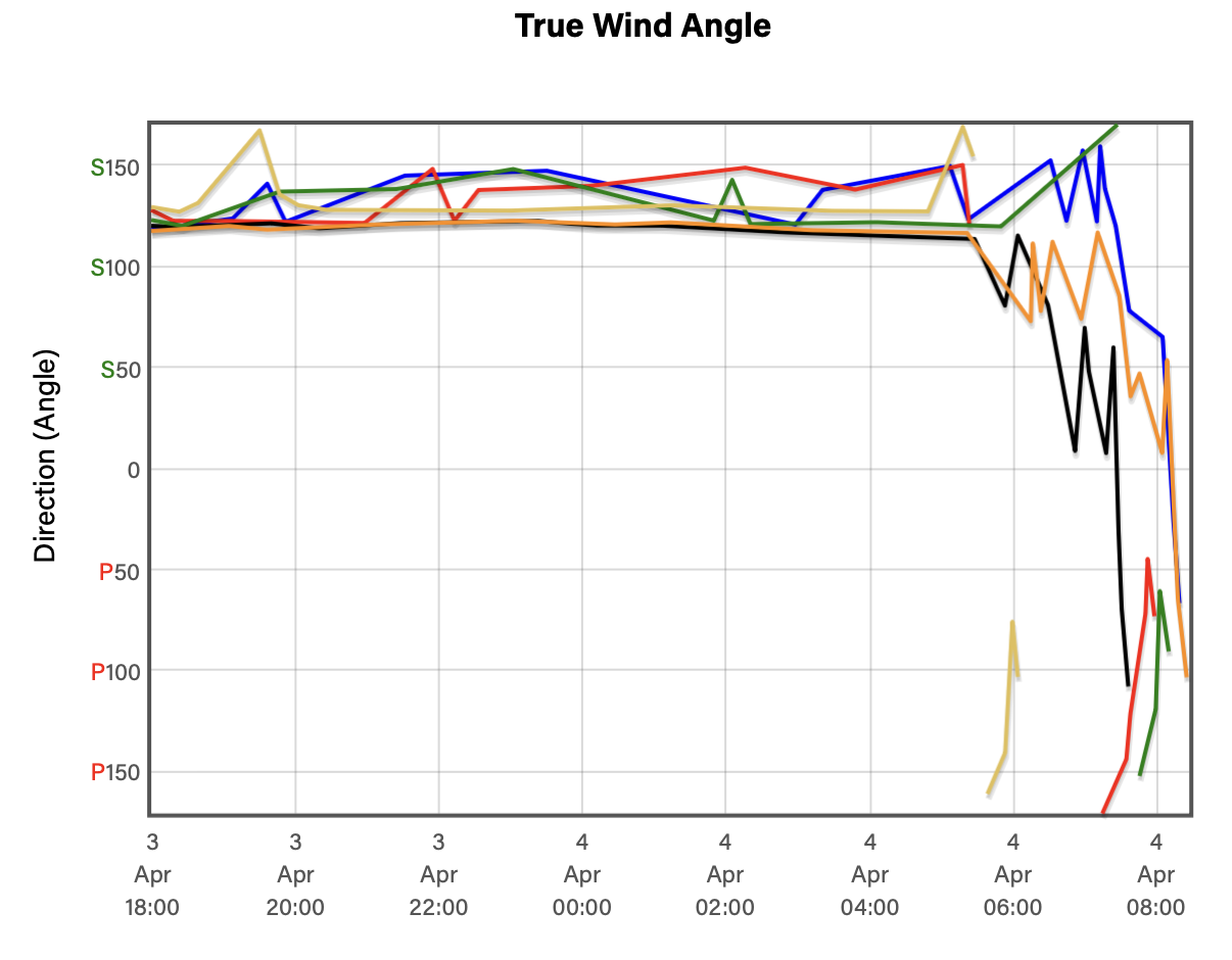
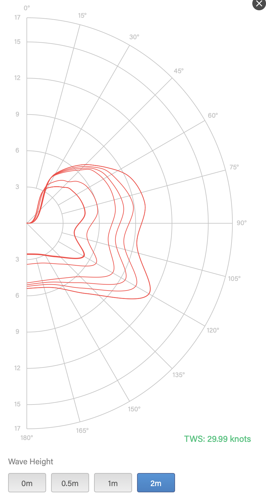
PredictWind’s Sail Routing also produces this information in graphical form. Here is the True Wind Angle across the entire trip. It’s around 130 degrees. That will work well for “Jack” our Code 65. We’ll reef the main to keep the speed down and because it’s a overnight passage with only one person on deck.
It’s A “Go”:
Sitting here five days out, Thursday looks like a good day to go. We’ll re-run this every morning to see if the weather models change their forecast and if those changes affect the conditions we’re expecting. If things start to look different, we may wait until a better “weather window” presents itself.
You can see why this is the best safety tool we have. The best way to deal with a storm is not to go out in one. The best way to reduce risk is to get off the ocean as soon as you can.
Inputs Into the Model:
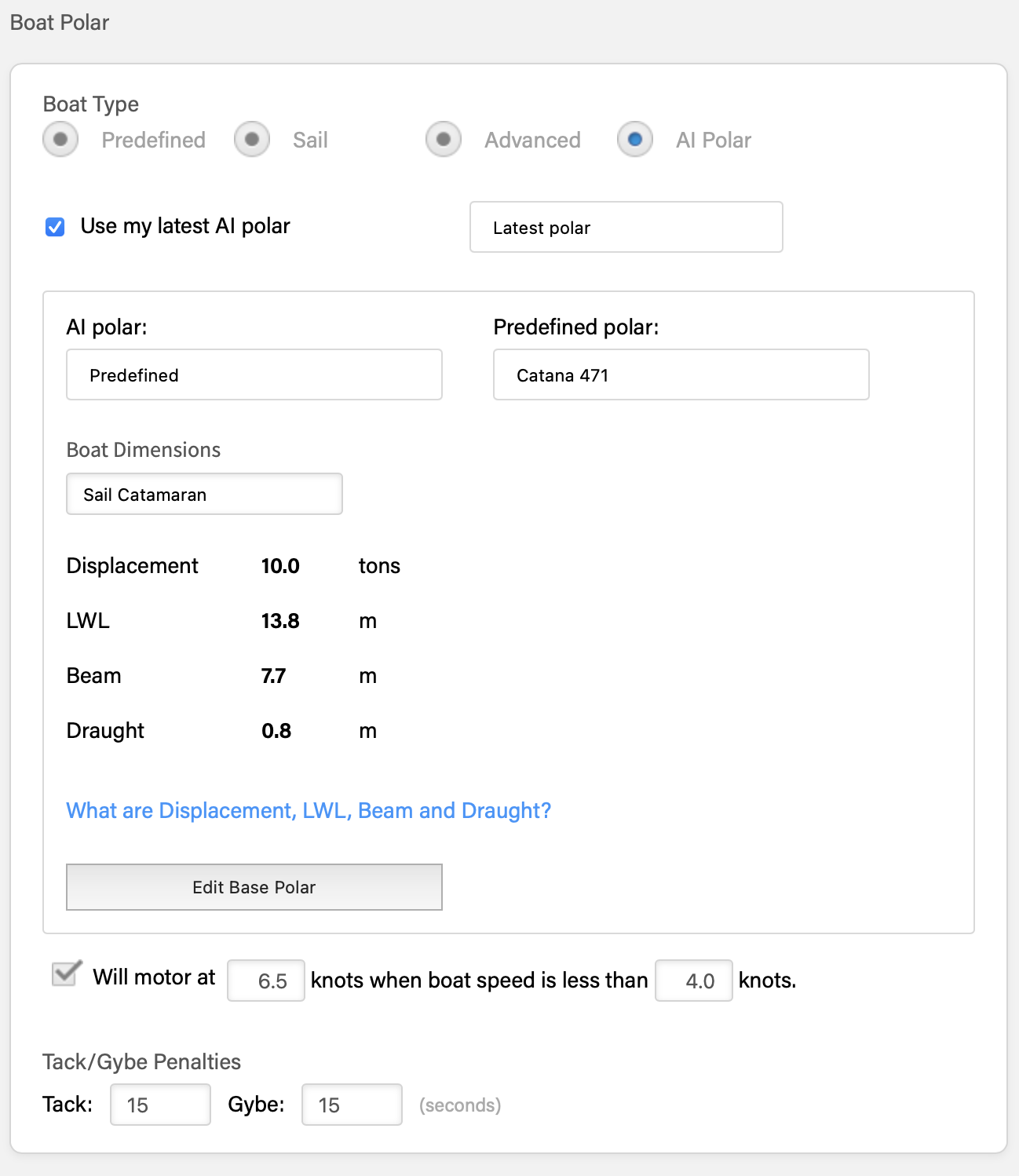
We have to give some inputs to the PredictWind model so it has something to work with beyond weather. We give it our desired comfort level and our boat’s “polars.” The “polars” tell the model how fast the boat will sail given a certain wind speed, wind angle, and sea state.
One reason we pay for the “professional” version of this software is that it constantly calculates our “polar” performance assumptions based on how we actually sail our boat. PredictWind calls it “AI Polars.” We have a “DataHub” that constantly records the performance data of our boat when we are sailing. It uploads that data via Starlink to PredictWind. They crunch that data and produce the performance assumptions we then use the next time we plan a trip. Pretty amazing.
Human Weather Routing Service:
We often engage the services of a professional weather router. We’ll do this for longer passages or in situations where we feel like we want more insight into our risks.
I typically work out a plan and then send it to our weather router for critique. He’ll often see things I don’t and make suggestions on timing and route.
We have been working with MetBob for the past year. He routed us across the Pacific last year. He also helped route us on a few passages around French Polynesia.
He writes an excellent blog focused on South Pacific weather.
I appreciate Bob’s willingness to engage in a discussion of our plan and not just give us sailing directions. It helps me learn and improve my own interpretation and decision-making.
Satellite Loop: Right Here, Right Now
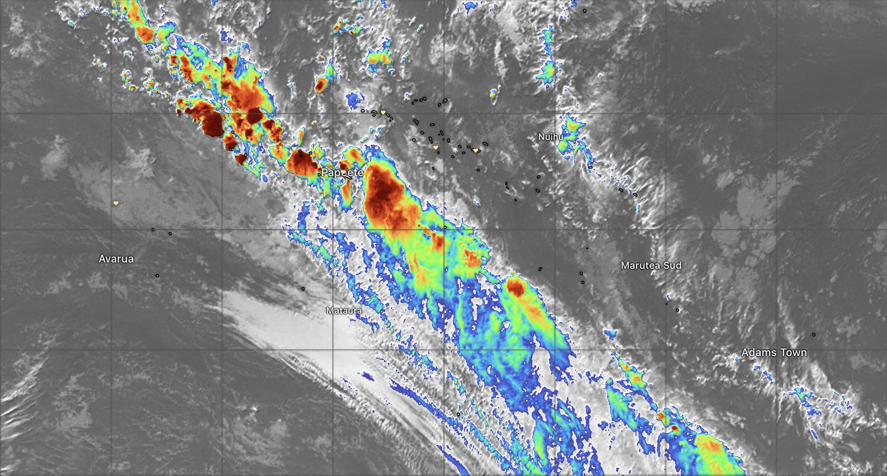
It’s hard to beat the current satellite loop image when you want to know what is happening right now and what is coming in the next hour or so. Windy has a great view. Turn on the infrared and lightening options.
South Pacific Weather
Many years ago Jim and Sue Corenman sailed their Schumacher 50, Heart of Gold, through the South Pacific. Jim wrote a series of articles for Latitude 38 Magazine titled, “Letters from the South Pacific.” They were the stuff of dreams for me. And here we are as a result.
Few people explain South Pacific weather as well as he.
Post Script to the Passage:
We made it to Huahine. How did it work out?
Short answer: Passage as planned; weather as forecast. That’s what we aim for.
The model forecasts didn’t change appreciably from Sunday through our departure on Thursday evening. The forecast conditions turned out to be spot on. The passage timing was within one hour of the plan. We had a mild squall just as we approached the pass into Fare, Huahine. Nothing major.
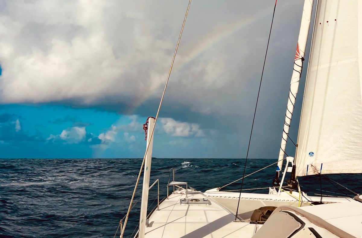
It was a glorious overnight sail. Fast and smooth. Just the way we like it.
Excerpt from our log
16 43.231s 151 02.329w
Fri Apr 04 2025 08:00:00 GMT-1000 (Tahiti Time)
All is well. We are once again anchored in the south flats near the town of Fare, Huahine. We arrived after a fantastic overnight passage from Mo’orea. We sailed a broad reach in slight seas with a reefed main and Jack, our Code 65. 1/3 daggers. Passage as planned, weather as forecast.
The GPS chip in our Starlink dish failed during the passage. The third dish we’ve had with this failure. Fortunately we have a spare dish but it is disconcerting this keeps happening.
Catana built 90 471s and finished 12 of them as 472s. One of those 12 is anchored next to us!
Comments
Loved the article. Sure a lot different than 23 years ago when we simply looked out the window, loaded up Esperanza, sailed out the gate and turned left. We’re actually here in La Paz this week. This morning we walked down to Marina Palmira where we lived through Hurricane Marty.
Enjoy your sail, looks like it will be a bit more comfortable than our crossing!
Great article, very clear, well written, and not dictatorial (hate those guys)!!! Worried about being able maintain 8 kts and departure/arrival anchorage issues so need to go at night? (Pam's favorite!!!)
Hola Miguel! Miss you guys! Yes, these tools are nothing short of miraculous. And for short passages of up to 3 nights, you have a good shot at completely avoiding bad weather (not so when it takes 16 days to cross the Pacific).
I remember our first Mexico cruise in the mid-90s. Not even weather fax back then. We tuned in the HAM radio and listened to an amateur forecaster in LA tell us what to expect. Things have changed!
We're getting geared up to start moving west!
Hola Alfredo! Thanks for the note. You have seen this sausage making first-hand.
These 8 to 12 hour passages are 'tweeners. In theory we could leave at the crack of dawn and get to the destination before dark. If we were arriving into our home slip in our home marina we'd have no hesitation finishing the passage in the dark. Out here it is different. We rely heavily on visual navigation to not run into things (like reefs). We like to arrive in the morning so that we don't have any time pressure working against us.
We've had a few occasions where we were chasing the fading light trying to get moored or anchored. It takes the fun out of it.
Arriving off an island in the morning gives us all day to enter the pass and sort out where to anchor.
The biggest challenge is keeping the boat speed down so we don't arrive off the island in the wee hours. There is risk in that as well. That happened the last time we sailed to Huahine. We got careless and didn't slow down early enough and wound up standing off the pass for several hours.
Exactly! You are wise and careful and a good pilot and I’ve been using the phrase “making sure there is plenty of runway” often here. People look at me, then they get it!! Its a classic risk/reward equation.
Ha! Running out of runway. The image that always comes to mind is screaming downwind with the spinnaker up pointed at the entrance of the Berkeley Marina thinking, "...damn, I hope we can get that spinnaker down..."
Don the amateur weatherman from maybe Santa Monica? He was a must listen in 2003.
It was on the Ham nets. Chubasco net IIRC. "Tango Papa's Weather" was the title of it. "Tom" was something-Tango-Papa. He had an HF rig in his car and many times he was pulled off to the side of the freeway giving his weather broadcast. Followed by all of the cruiser check-ins giving their barometer readings which went down 1MB at night and up 1MB during the day, day after day. And nobody knew what the heck to do with that information. Back then, the weather was what you got that day.
I'm loving your well planned out approach to passage making. I'm curious whether your analysis has gotten more scrupulous on a catamaran than it was on a single hull vessel. I know that cats tend to be more stable to live in, but when the sea is rocky, I imagine it becomes even more rocky in a cat than it is in a single hull. Just wondering if that has changed the way you plan your passages.
Or is your detailed passage planning more a factor of this is your 2nd cruise and have decided there is no need to make things rough if you can avoid it.
I met a couple in Niue, who hated sailing and often waited for the smoothest seas possible and then motor through as fast as they could. I never understood what they were doing out there, other than they wanted to sail their boat to New Zealand to sell it there. But you could tell they were miserable.